Description
Chapter 32:
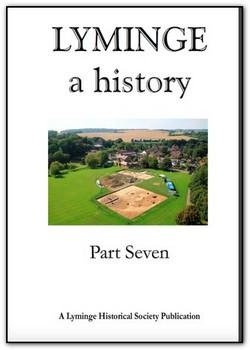
Lyminge Excavations 2014: Dr G Thomas and Dr A Knox
Interim report on the University of Reading excavations at Lyminge, Kent.
See photos on inside front cover, inside back cover.
Chapter 33:
The Hogben Map in the Village Car Park: Duncan Harrington
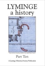
The map created in 1760 by Thomas Hogben sets out the lands belonging to the vicarage and glebes (pieces of land serving as part of a clergyman’s benefice and providing income) of Lyminge united with the chapels of Stanford and Paddlesworth together with the lands belonging to the Court Lodge.
Chapter 34:
Thomas Hogben (1702-1774): John Foad
This interesting article on Kentish sundials, which is not specific to Lyminge, tells of the sundials made by Thomas Hogben of Smarden, mentioned in the above chapter.
Chapter 35:
Wheelbarrow Town: David McDine
This is an intriguing conjecture on the origins of a local place name.
See also photos on inside back cover and back cover.
Chapter 36:
The Queen, The Virgin and the Body Snatchers: Robert Baldwin
How Lyminge Parish Church erroneously acquired its current dedication to Saint Ethelburga.
This chapter explains how Queen Ethelburga, who founded the first church at Lyminge in the 7th Century, has become confused with Saint Eadburg, whose relics were transferred to Lyminge in the early 9th Century, and as a result, the church dedication was mistakenly changed at the end of the 19th Century from St Mary & St Eadburg to St Mary & St Ethelburga.
Chapter 37:
A Grave Mystery or a Stone Unturned: Michael Chisnall
A detective story concerning one of two gravestones from the Methodist cemetery regarding George Broadridge and his wife Susanna and their three daughters. George died in 1874 and Susanna in 1850.
Chapter 38:
The old Methodist Burial Ground: Duncan Harrington
The second gravestone, which had been recently retrieved from number 3 Wesley Terrace, intrigued the author sufficiently to research this further. The stone is dedicated to Richard William, (died aged 20 in 1854) and Elizabeth Ann Rigden (died aged 12 in 1853) son and daughter of Edward and his wife Jane Rigden.
Chapter 39:
More Childhood Memories of Lyminge: Phipps and Harrington
This article is from the recollections of Douglas Phipps from an interview made by Duncan Harrington on 24 February 2015 and expanded with research into Douglas’s family history.
Chapter 40:
Old Ordnance Maps of Lyminge: Alex Kent
This fascinating examination of the village is seen through a series of Ordnance Survey maps showing Lyminge in 1873, 1898, 1907 and 1945.
The chapter also gives the origins of Ordnance Survey.
Chapter 41:
Spiders in and around your home: Ed Allan
Arachnaphobes look away now! This chilling description of local spiders is enough to make you head for the hills.
Chapter 42:
The oil lamps lighting Lyminge streets: Duncan Harrington
Further to the article in Lyminge a History part 2, Chapter 7, concerning Albert Tanton who was the Lyminge lamp-lighter, this chapter elaborates further through the minutes of the Parochial Committee on the oil lamps being lit in the village, between 1920 and 1933.
Chapter 43:
Westenhanger Castle and the plight of a widow:
Duncan Harrington
In the late 14th Century, Lettice Crioll, a widow, endured being terrorised for four hours by Sir John Cornwaille after he tricked his way into her fortified Kent manor dressed as a friar and then let 40 armed men inside.

